
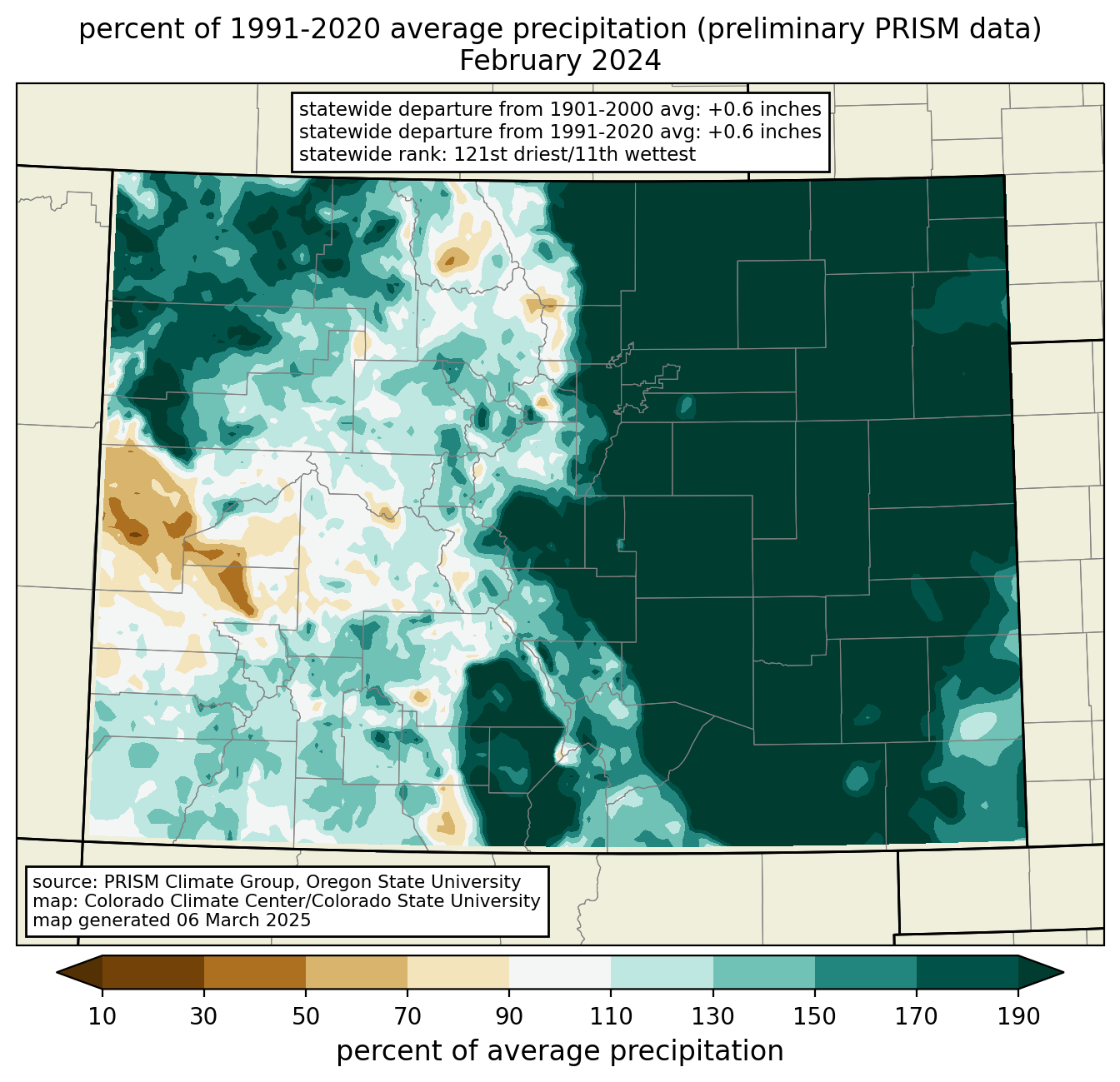
Temperature and precipitation rank and anomaly maps are available for every month, on 1- to 12-month timescales, back to 1896. These maps are made from preliminary data from the PRISM Climate Group at Oregon State University and are not considered official. For the official rankings based on data published by NOAA, please see this page. Select a year, month, and timescale from the drop-down menus. Click on the maps to enlarge the image.