How about some snow trivia?
 Much of the water supply for seven western states begins as snow in the mountains of Colorado.
 The albedo of fresh white snow is about 80%. This means the surface is highly reflective of
the sun's radiation. This is why a snowy field can appear so blindingly bright on a sunny day.
It's also why temperatures struggle to warm up - all the sun's energy is working on
melting that snow away!
 Snow can act as an insulating "blanket". Even though we associate snow with cold, on
extremely cold days, snow cover can actually protect soils from deep freezes.
How do we get snow in Colorado?
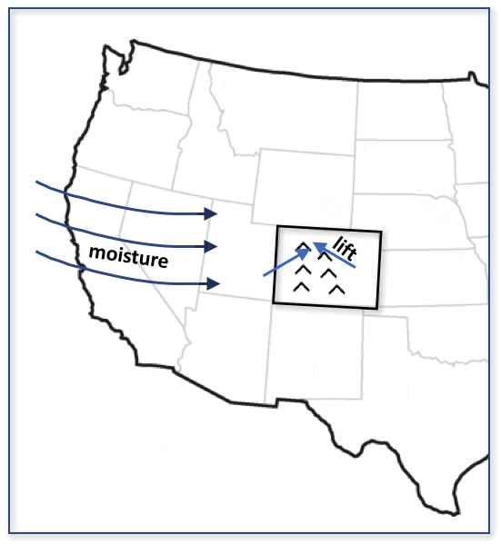
Snow (actually precipitation in general) requires three ingredients: A source of moisture
 Upward vertical motion (or lift)
 Instability
What spots in Colorado get the most snow?
Now that we know what ingredients are needed, the story for Colorado becomes a bit clearer. The mountains get more snow than the eastern plains, and the highest mountains get the most snow. Remember that requirement for vertical motion? Well, a whole lot more vertical motion is provided at the mountain tops than at the foothills! Also, by the time a storm has passed by, the mountains have squeezed out most of the moisture, and there is very little leftover for the plains.
So, it's no surprise to know that the snowiest locations in the state are at the highest elevations, and the least snowy are nestled in the valleys or out on the lower elevations of the eastern plains.