Index of /maps
Name
Last modified
Size
Description
Parent Directory
-
wwdt/
2022-06-12 15:04
-
us_counties.geojson
2018-06-25 17:20
5.7M
swe/
2026-04-05 17:44
-
rccs_with_bgc.png
2025-12-04 13:10
180K
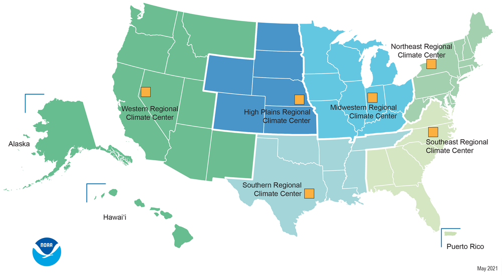
rccs.png
2025-12-04 13:07
308K
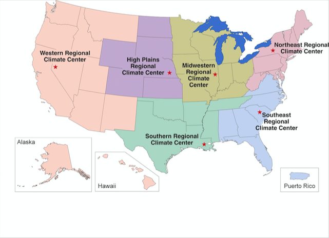
rcc_map.png
2017-07-06 14:16
190K
qpe/
2026-01-01 07:15
-
prism/
2026-06-02 06:39
-
precip_proj_stn_meta_imw.csv
2021-02-03 18:31
2.3K
precip_proj_stn_meta.csv
2019-02-27 17:23
912
precip_map_int_since.php
2020-12-01 17:56
5.0K
precip_map_int_dev.php
2024-09-22 10:29
5.0K
precip_map_int.php
2024-09-22 12:25
5.0K
precip_map.php
2020-12-01 18:00
5.1K
plotly_test.html
2024-09-22 12:24
3.0K
plotly_precip_since_map.php
2020-12-01 17:43
6.8K
plotly_precip_map_old.php
2024-09-22 10:56
7.5K
plotly_precip_map.php.save
2024-09-18 14:35
7.5K
plotly_precip_map.php
2024-09-22 10:55
7.5K
plot_map.R
2016-10-17 14:59
480
ncei_nclimgrid/
2025-05-28 11:21
-
load_images.php
2020-07-06 14:35
919
latest_date.txt
2026-06-08 17:05
9
hprcc_precip_apr1_latest.csv
2020-07-14 17:00
37K
hprcc_precip_30day_latest.csv
2020-07-14 17:00
30K
hprcc_precip_7day_latest.csv
2020-07-14 17:00
19K
hprcc_apr1_precip_current.png
2020-07-14 17:00
370K
hprcc_30days_precip_current.png
2020-07-14 17:00
342K
hprcc_7days_precip_current.png
2020-07-14 17:00
291K
common.inc.php
2020-12-01 17:59
1.1K
co_mly_precip.csv
2016-10-17 14:58
25K
co_map_data3.png
2016-10-17 10:41
132K
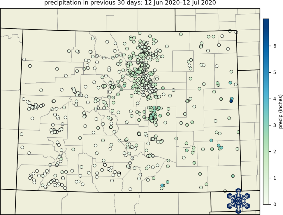
co_map_data2.png
2016-10-17 14:59
103K
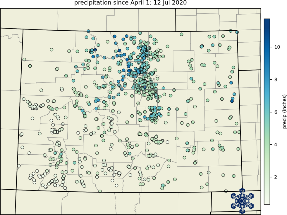
co_map_data.png
2016-10-16 09:05
54K
allstations.png
2017-02-07 18:16
155K
acis_ytd_precip_current.png
2026-06-08 17:05
385K
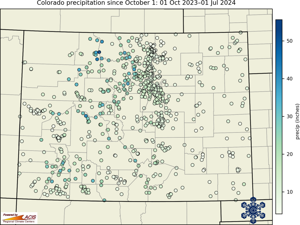
acis_wytd_precip_current.png
2026-06-08 17:05
388K
acis_precip_ytd_latest.csv
2026-06-08 17:05
74K
acis_precip_wytd_latest.csv
2026-06-08 17:05
75K
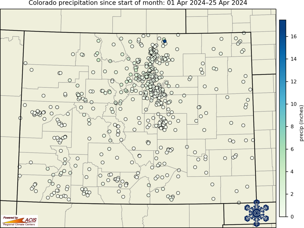
acis_precip_mtd_latest.csv
2026-06-08 17:05
55K
acis_precip_120days_latest.csv
2026-06-08 17:05
72K
acis_precip_90days_latest.csv
2026-06-08 17:05
70K
acis_precip_60days_latest.csv
2026-06-08 17:04
67K
acis_precip_30days_latest.csv
2026-06-08 17:04
61K
acis_precip_14days_latest.csv
2026-06-08 17:04
59K
acis_precip_7days_latest.csv
2026-06-08 17:04
55K
acis_mtd_precip_current.png
2026-06-08 17:05
351K
acis_days_since_precip_latest.csv
2026-06-08 17:06
13K
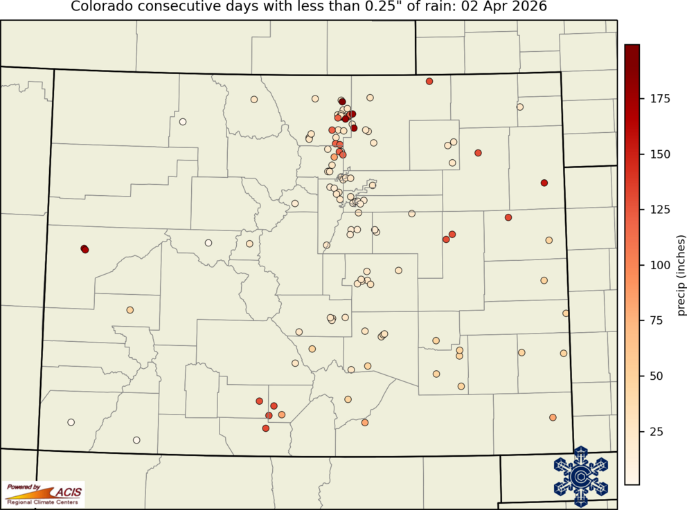
acis_days_since_0.25_precip_current.png
2026-06-08 17:06
229K
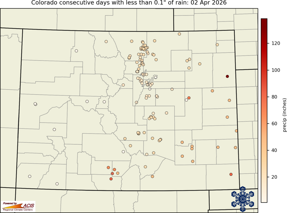
acis_days_since_0.1_precip_current.png
2026-06-08 17:06
229K
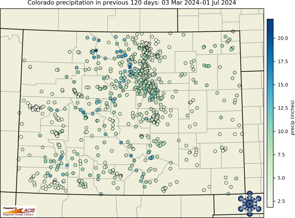
acis_120days_precip_current.png
2026-06-08 17:05
390K
acis_90days_precip_current.png
2026-06-08 17:05
382K
acis_60days_precip_current.png
2026-06-08 17:05
374K
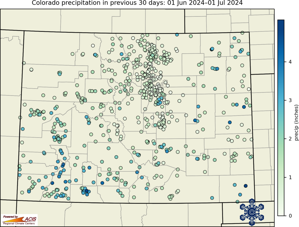
acis_30days_precip_current.png
2026-06-08 17:05
358K
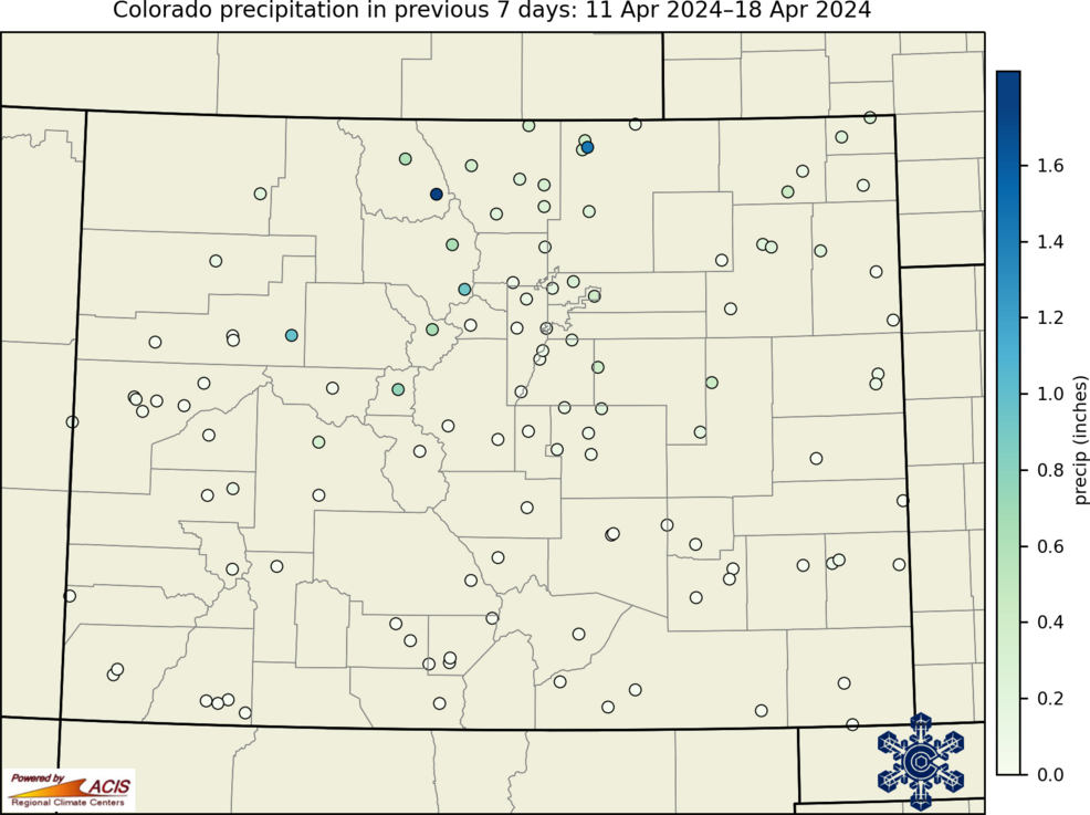
acis_14days_precip_current.png
2026-06-08 17:05
354K
acis_7days_precip_current.png
2026-06-08 17:05
352K
2026/
2026-06-02 11:05
-
2025/
2025-12-02 10:05
-
2024/
2024-12-02 10:05
-
2023/
2023-12-01 17:05
-
2022/
2022-12-01 17:05
-
2021/
2021-12-02 11:06
-
2020/
2020-12-01 17:05
-