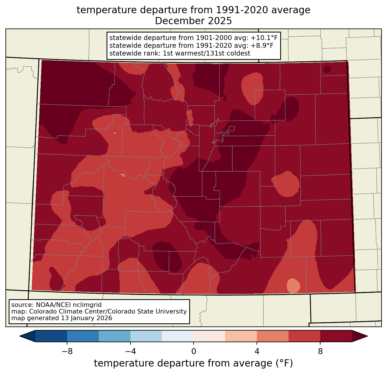
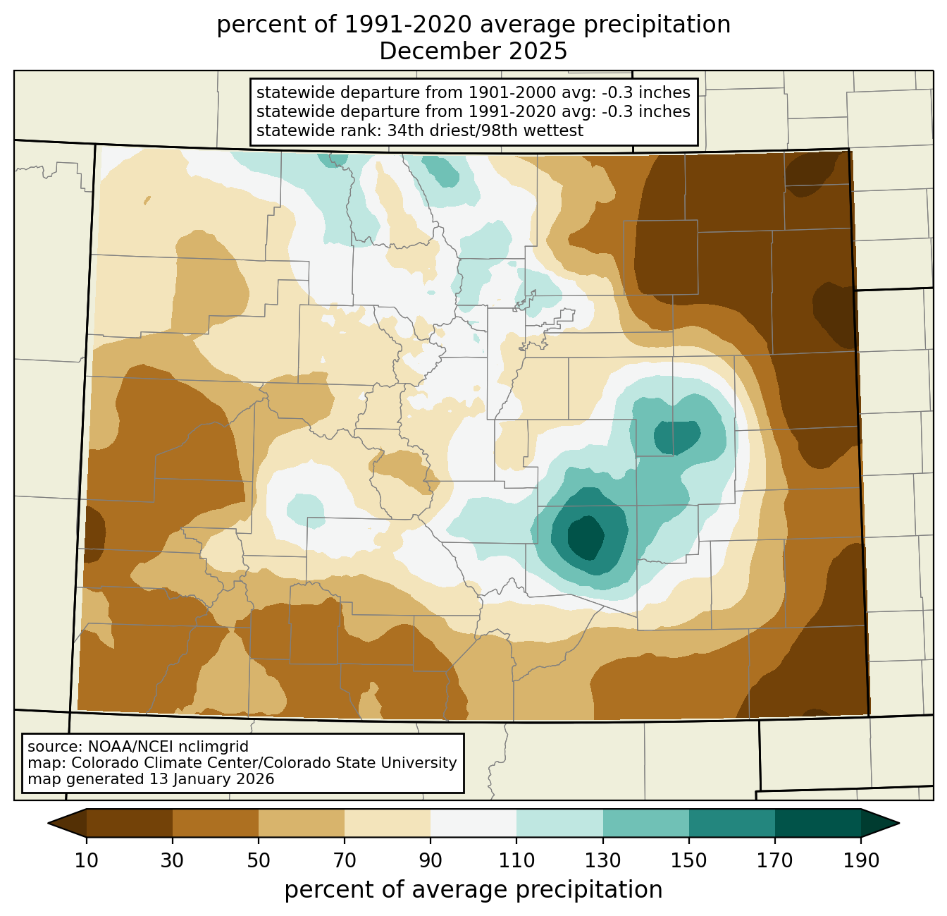
Temperature and precipitation rank maps are available for every month, on 1- to 12-month timescales, back to 1896. Current month maps are updated around the 8th of the month, when published by NOAA National Centers for Environmental Information. For unofficial rankings that are available sooner after the end of the month (usually the 2nd day of the month), see our maps based on the PRISM dataset. Select a year, month, and timescale from the drop-down menus. Click on the maps to enlarge the image.