|
|
Drought Early Warning System June 30, 2020 |
|
Precipitation ![]()
These images are produced by the Colorado Climate Center and use precipitation data from NWS COOP, NRCS SNOTEL, CoCoRaHS, and CoAgMet stations to generate the gridded products. Images are generally updated every Tuesday. When maps are unable to be updated, AHPS precipitation is shown, courtesy of the National Weather Service.
Standardized Precipitation Index ![]()
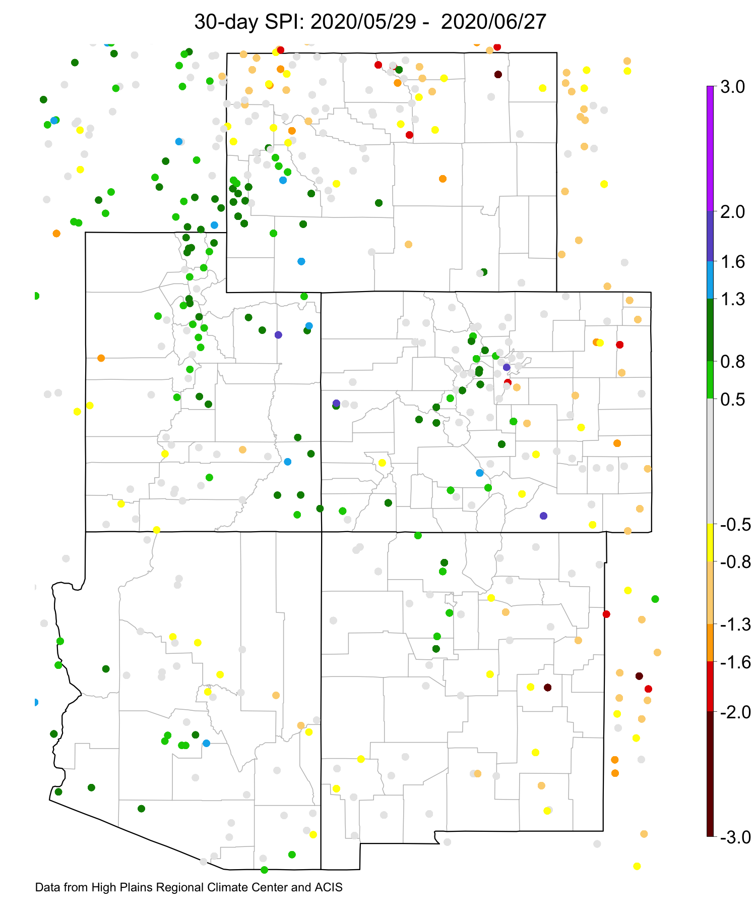
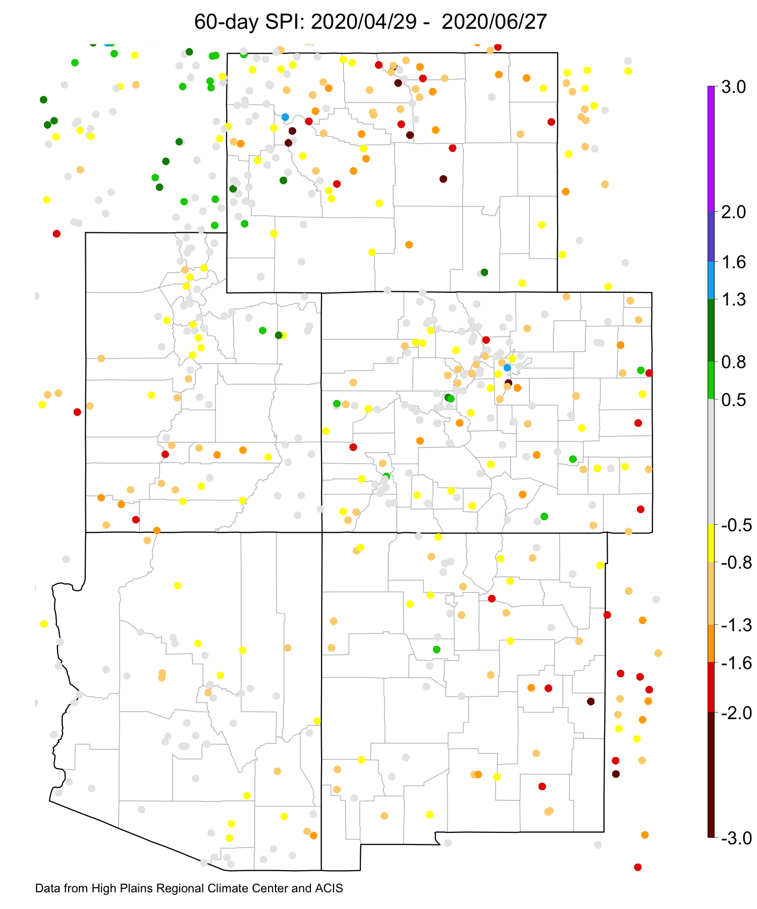
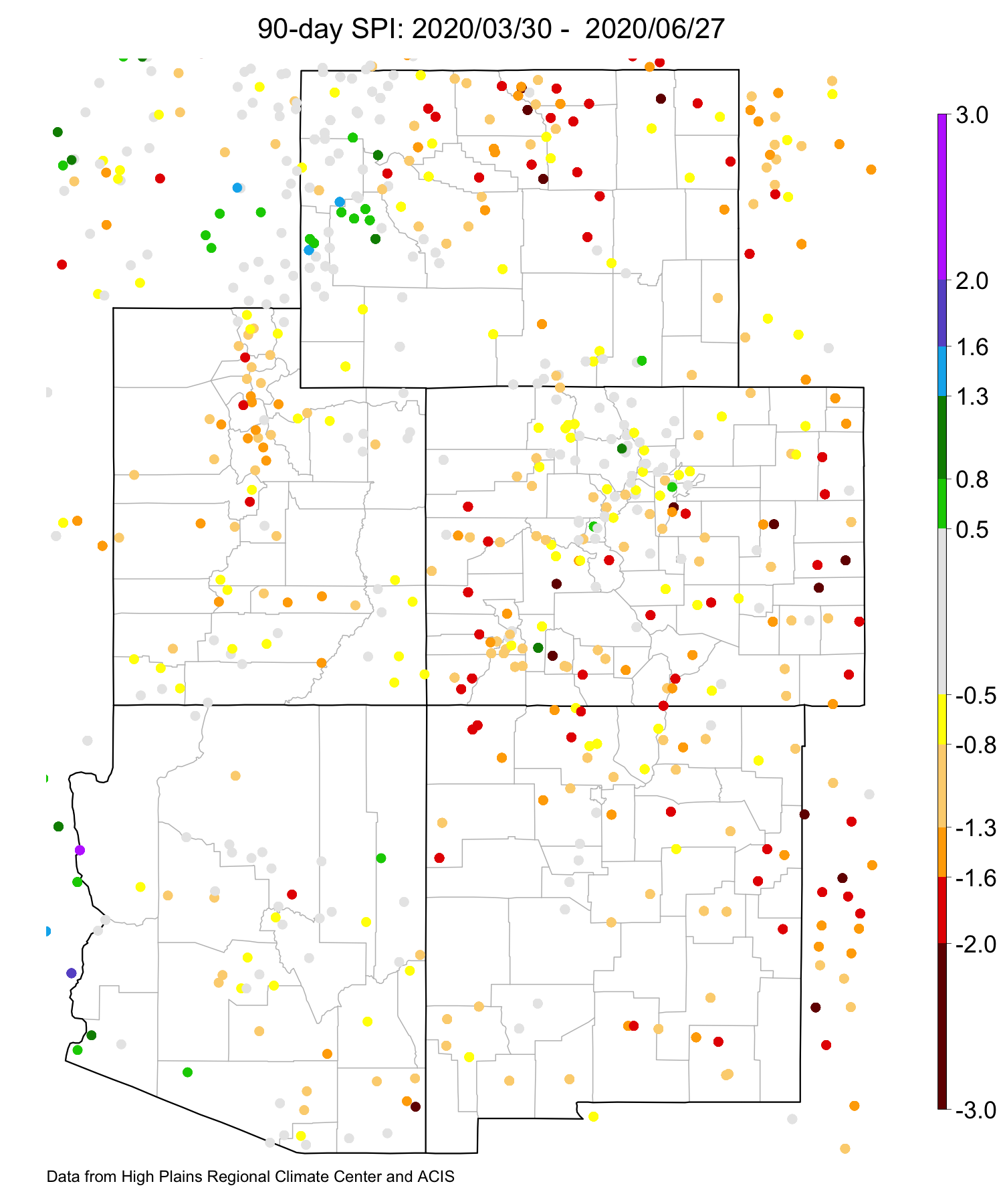
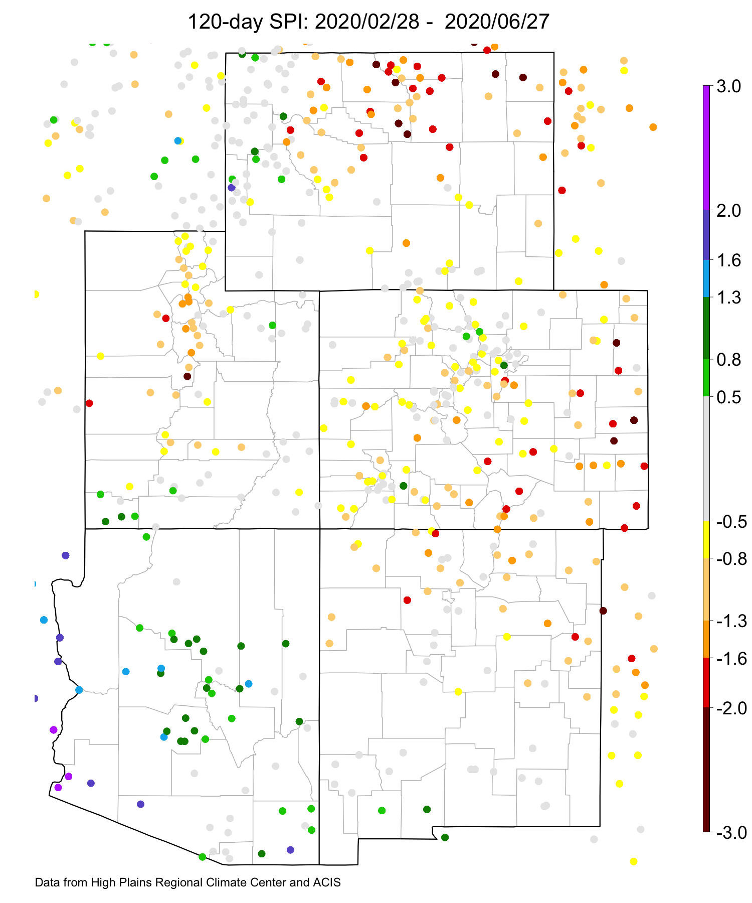
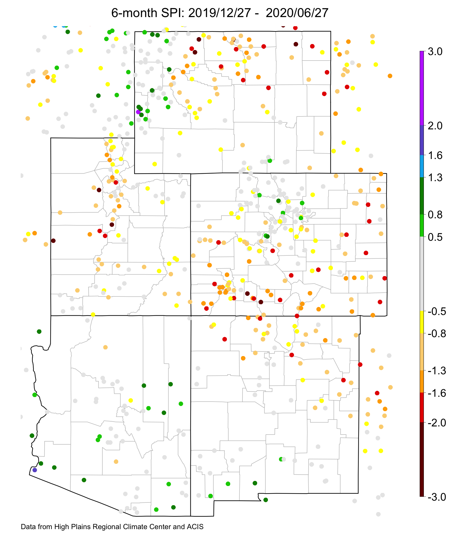
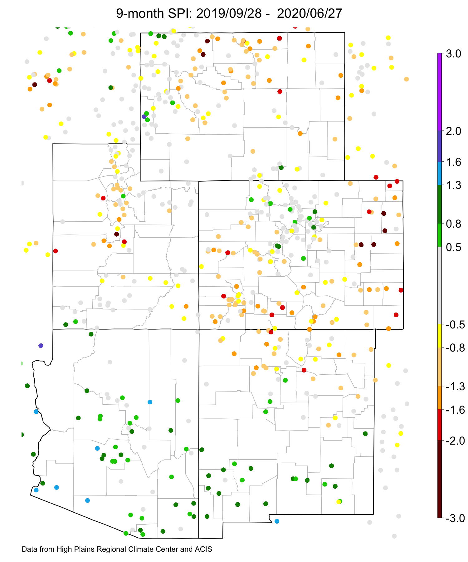
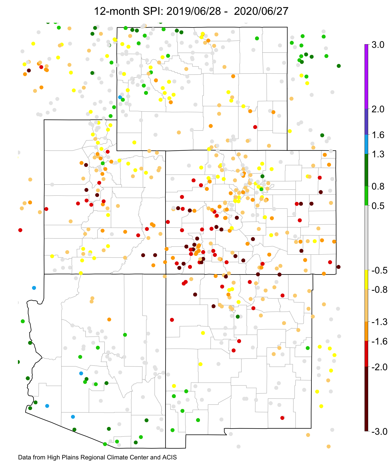
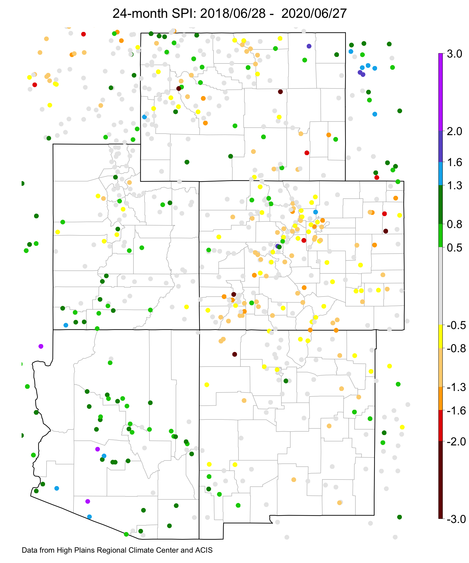
SPI data are provided by High Plains Regional Climate Center.
SNOTEL Precipitation Percentile ![]()
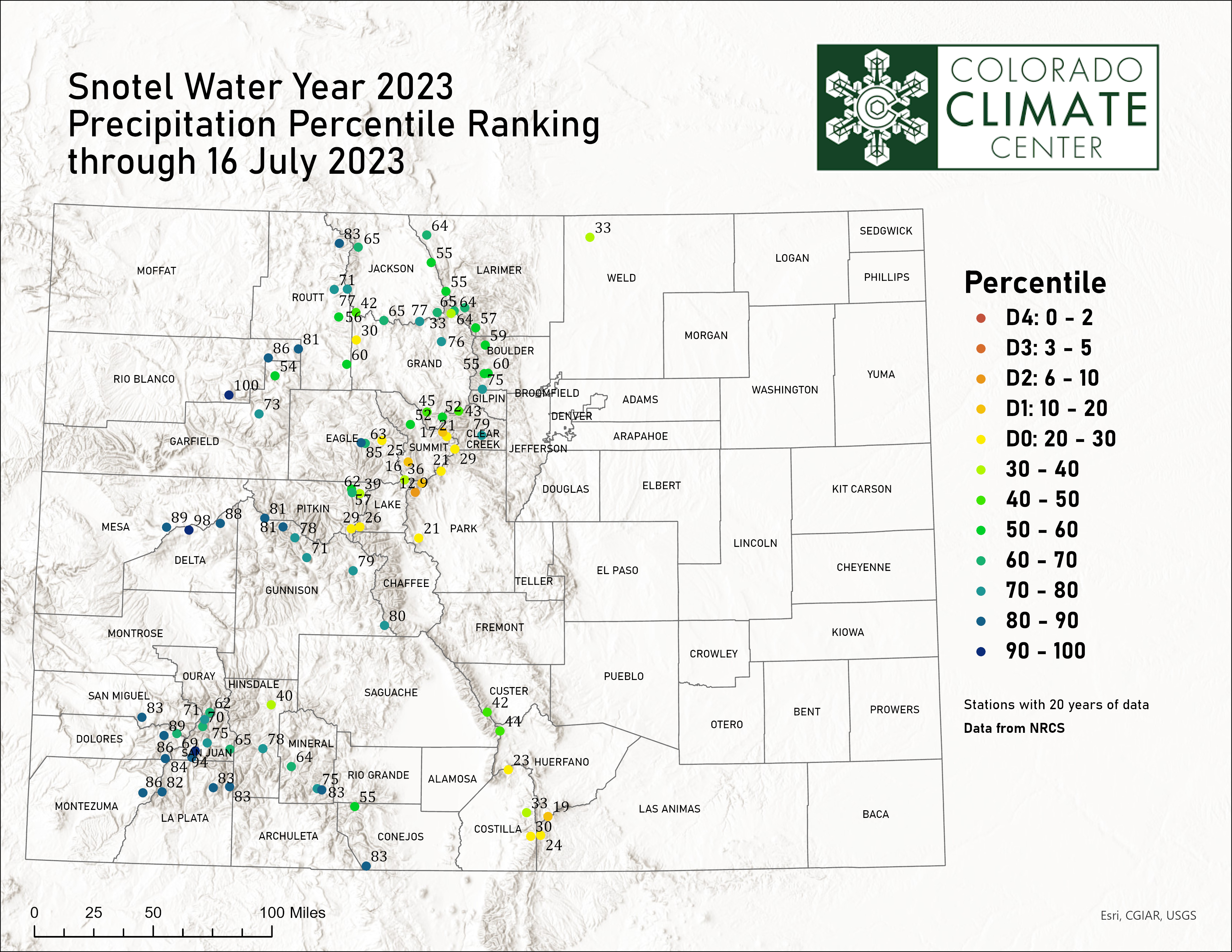
SNOTEL precipitation data are provided by Natural Resources Conservation Service. Calculated water year percentiles and maps are produced by the Colorado Climate Center and are typically updated every Tuesday.