The six months from May through October were the warmest on record across Colorado, and parts of the state had been quite dry over that time period; you can read more about those statistics in our October monthly summary. Then in early November, things turned around in a big way across southern and eastern Colorado, with a huge snowstorm from November 4-10 (or really, a couple storm systems that affected the state, one right after the other). There were some remarkable snow totals, with reports of up to 60 inches (5 feet) in the Sangre de Cristo Mountains, and widespread 24-36 inches on the southeastern plains.


This amount of snow, especially at the lower elevations of eastern Colorado, doesn’t happen very often. Here is a list of the top seven-day snowfall totals at stations in Colorado east of -104.5° longitude, which excludes mountain/foothills locations. There five snowstorms that show up on this list.

One that appears several times is the historic storm of early November 1946. That storm produced 50 inches of snow at Eads and 46 inches at Karval, easily the biggest low-elevation snowstorm in state records. You can find plenty of photos and stories about that storm; I enjoyed reading this one from Time Magazine, which gives a sort of poetic sense to a storm that disrupted many lives and industries.
But the second-highest total in this portion of the state was 46 inches that fell from November 4-10 of this year, on the northeast side of Trinidad. The November 2024 storm also had impressive totals of 41″ near Deer Trail, and 34″ near Simla. These really are huge snow totals for eastern Colorado. I think it’s fair to say that the November 2024 storm is only topped by November 1946 for low-elevation snowfall in eastern Colorado.
Other historic storms that show up on the list for eastern Colorado were in late December 2006 (two storms within a week of each other), and in 1980 in northeast Colorado. (If you allow Front Range/foothills locations, then other historic storms like December 1913 and March 2003 also appear on the list. See this presentation from 2005 by Nolan Doesken on “Colorado Classics” for a walk through snowstorm history.) Many people have memories of the October 1997 snowstorm, which was a major storm in southeast Colorado as well, but in terms of snow accumulation, it didn’t even make this list.
The November 1946 and 2024 storms had a lot in common
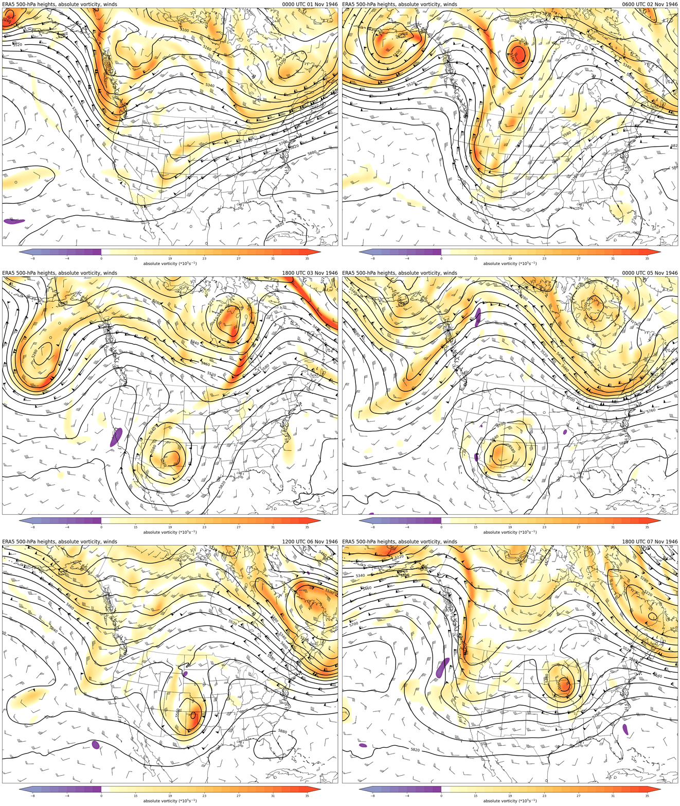
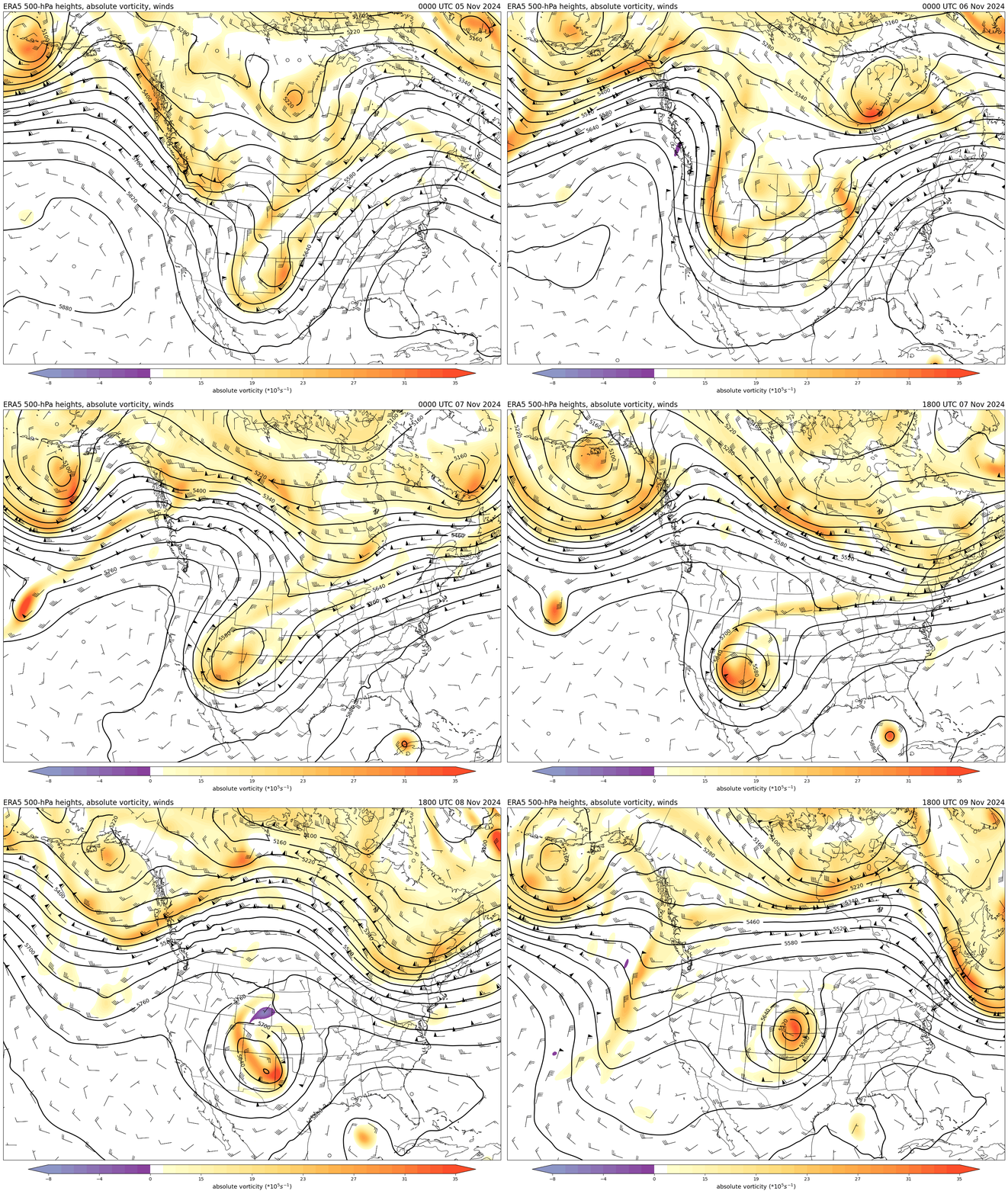
If we take a quick look at the November 1946 and 2024 storms, we see that they had a lot in common. First is the obvious — they happened at almost exactly the same time of year. But there were also a lot of similarities in the meteorology. Here are animations of the 500-hPa heights and vorticity for these two storms in the ERA5 reanalysis. For the non-meteorologists, this is a measure of the “spin” in the atmosphere. The maps highlight that in both events, a strong upper-level disturbance became cut off from the main flow and parked itself over Arizona and New Mexico for a couple days, before moving northeastward across eastern Colorado and into the Great Plains. This is the type of large-scale setup that favors long-duration precipitation over southern Colorado, while still being just cold enough to be snow rather than rain. The main difference between the two events appears to be that the 1946 storm sat in place for about an extra day compared to the 2024 storm.


Very wet snow
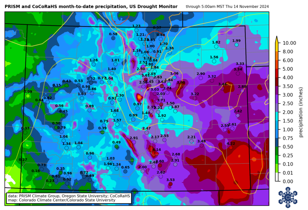
Although the snow was very disruptive to travel and agriculture (and pronghorns), it will also have longer-term positive effects on the drought situation in southeastern Colorado. This part of the state had an extremely dry spring, which got the growing season off to a bad start. Precipitation through the summer was closer to average, but it was a very hot summer such that drought and its impacts persisted through the early fall. But the November snowstorm brought widespread 2-5″ of precipitation (liquid equivalent in snow, and/or rain in spots that stayed slightly warmer.) These are huge precipitation amounts for this time of year on the plains. Most of southeastern Colorado has already guaranteed that the November through February period will have more precipitation than average (right image below). And the spots in the darker green on that map received in one week more than twice the average precipitation that would typically fall from November through February!


All of the precipitation led to widespread improvements on the US Drought Monitor, with parts of southeast Colorado seeing a two-category improvement, from D2 (severe drought) to D0 (abnormally dry; there are still precipitation deficits on long timescales in this region). In contrast, northern Colorado received much less precipitation from this storm, and improvements were more limited, with D2-D3 (severe-extreme) drought remaining in Larimer and Weld Counties.
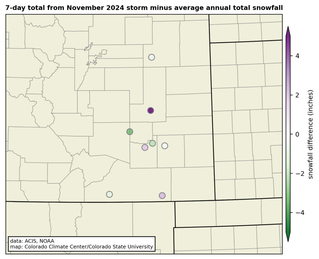
What does this mean for the rest of the winter? Well, there was an analysis in the Washington Post this week that showed projections for winter (December-January-February) snowfall across the US, and it showed below-normal snowfall across the southern US, including southern Colorado. This projection is connected in part to the La Niña pattern that is emerging. Now, keep in mind that the Post analysis was specifically for the winter season, so the huge November storm is not included in the forecast period. But some locations exceeded their entire annual average snowfall total in this one storm! The stations on the map below were either within a few inches of (in green), or even more than (in purple) their average annual total. The dark purple dot is Karval, which averages 21″ of snow per year, and had 27″ in this storm. Stations at Rocky Ford and Kim also exceeded their annual average in this one storm. So, while technically a projection of below-average snowfall for the winter (Dec-Jan-Feb) could still come true, much of southeastern Colorado has already clinched a snowier-than-average cool season from this single major storm.

What about mountain snowpack?
This storm brought some very big amounts to the southern mountains, especially the Sangre de Cristos. On November 9, the SNOTEL stations in the Arkansas River basin exceeded their previous record high snow-water equivalent (SWE) for the date. It never hurts to get a good early start to the snowpack! But also keep in mind that the mountains get a lot of snow in even an average year. In other words, it really is very early. The Arkansas basin now has about 25% of its usual peak for the season—much higher than usual for mid-November, but there is still a *long* way to go. La Niña generally brings below-average snowpack to the southern mountains overall, so we will just need to wait and see.


