Across Colorado, this December has been much warmer than average, a bookend to what will end up as one of the warmest years on record statewide. Except there’s one spot where December hasn’t been warm at all — very much the opposite.
On any climate map of Colorado for December 2024, Gunnison sticks out like a sore thumb. For example, here are the high temperatures from CoAgMET on Friday, December 20. Really warm for late December, including some record highs along the Front Range. But then there’s Gunnison with a high of just 22°F.

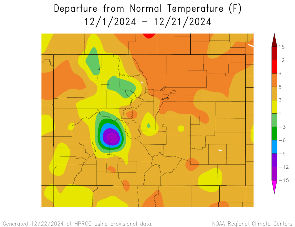
And here’s the departure from the average temperature for December through the 21st. Most of the state is 3-9°F warmer than average…and then there’s the bulls-eye of purple around Gunnison. For the week of December 15-21 it’s even more stark: almost the entire state in a deep red of warmth, with Gunnison again in a cold purple. Typically when we see maps like these, we get suspicious about problems with the data or a faulty thermometer, but this isn’t an error. Gunnison has truly been an anomaly in the state’s weather and climate this month.


Here are a few more remarkable stats. From December 1-20, the climate station outside Gunnison has been 13 degrees colder than average. The highest temperature reported so far in December has been 26°F; there’s never before been a December without a high above freezing. (The average high at Gunnison this time of year is in the upper 20s.) And there were 15 straight nights with low temperatures below -10°F, including record lows of -26 on November 30 and -23 on December 1.

So why is it not warming up in Gunnison?
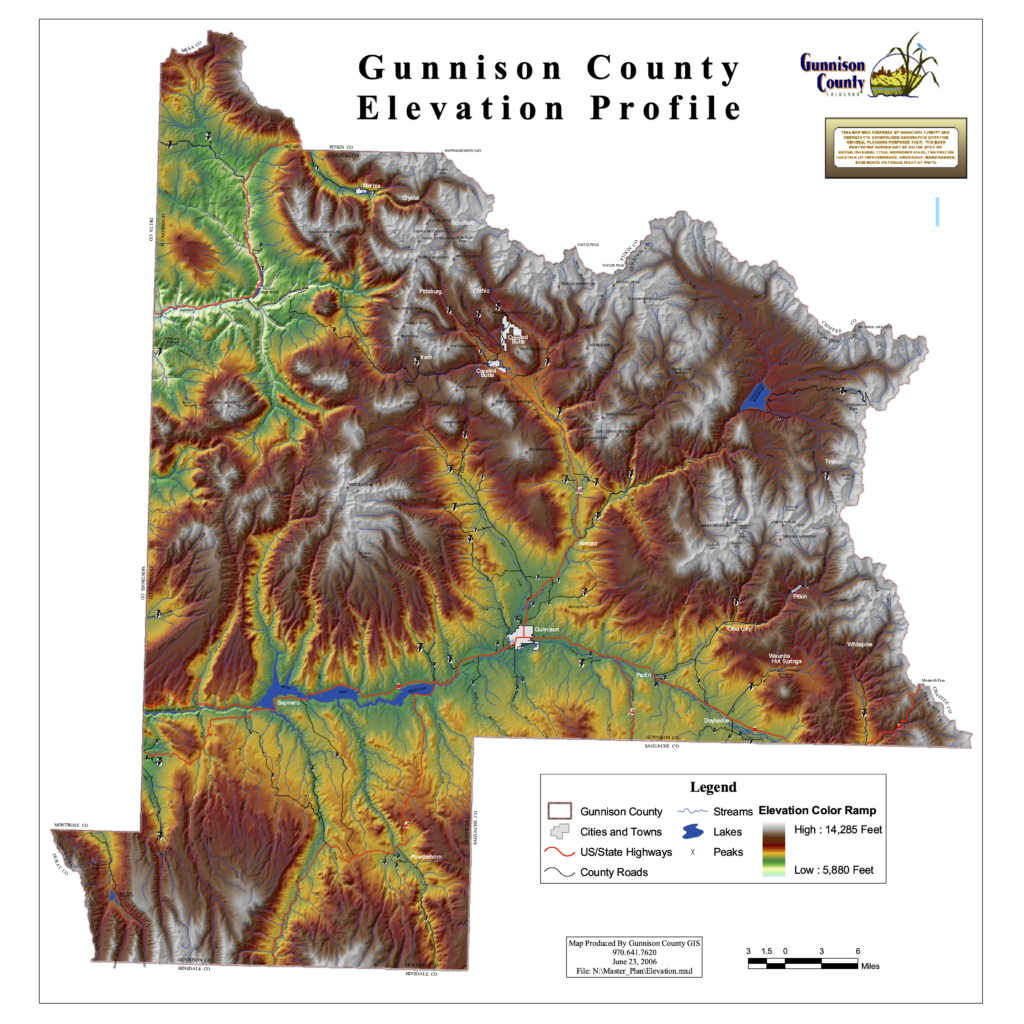
Two key factors are causing the remarkable cold, compared to the warmth the rest of the state has seen in December. The first is geography. Gunnison sits in a valley, surrounded by mountains on all sides. Northeast of town, the Taylor and East Rivers come together to form the Gunnison River, and the confluence with Tomichi Creek is just to the west. Cold air is known to pool in high mountain valleys like this, and the cold can be very persistent.


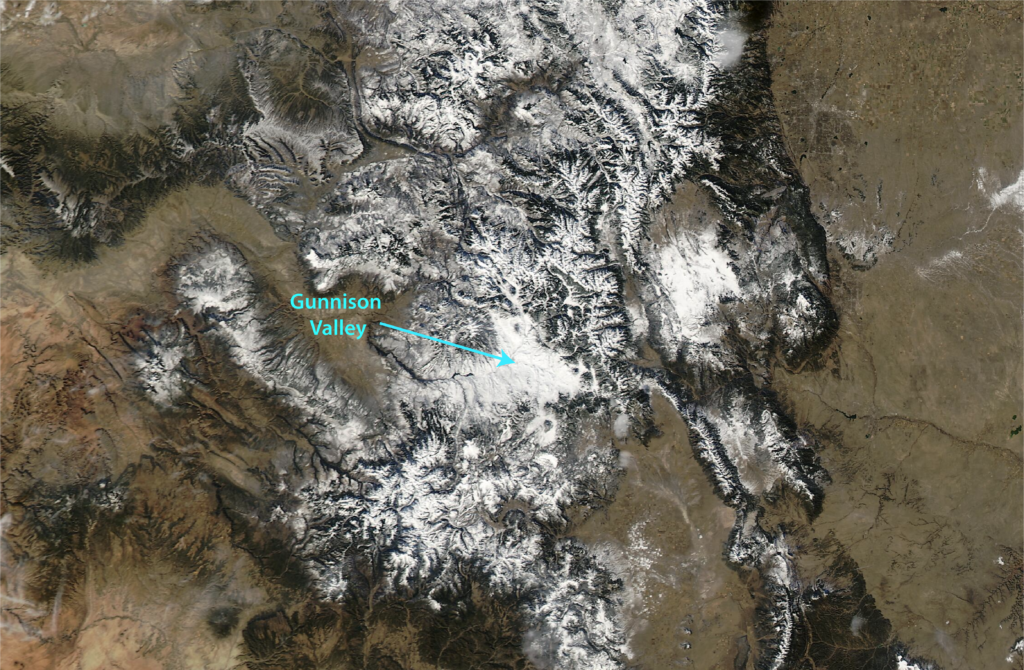
If there’s a bunch of snow on the ground, these valley cold pools can become especially stubborn, and that’s exactly what’s happened this month. The storm just before Thanksgiving dropped over a foot of snow in the valley, and over 2 feet in the nearby mountains, among the highest totals from this storm. And even though the larger-scale air masses have been warm through December, the snow has remained in the valley (clearly visible in the satellite image above) and the air hasn’t warmed up. When there’s deep snow cover, it reflects sunlight and keeps the days cool, and also favors cold nights by insulating the air from the warmer land underneath. This creates a feedback loop where it stays cold, which means the snow doesn’t melt, which means it stays cold.
What’s especially unusual is that this has all happened without getting additional snowfall: Gunnison has reported only 0.5″ of snow in December. The mountain snowpack has flatlined through December, and up the hill at Crested Butte they’ve even had several days above freezing. But it’s still snowy and cold in the Gunnison Valley, and will stay that way for the foreseeable future. What looks more likely is that the rest of the state will start to cool down to something resembling winter in early January, so Gunnison won’t look like such an outlier.


