


We are still testing some things out in the setup of the blog, so we’ll consider this post a “soft launch” that can help with working out bugs as well.
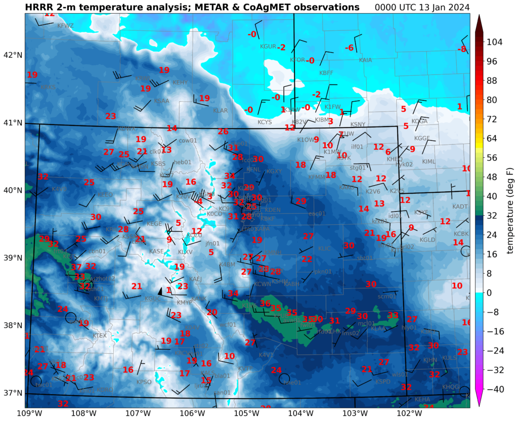
A strong cold front moved through the High Plains on Friday, January 12, 2024. In the Arctic air mass behind the front, temperatures dropped well below 0°F as of Saturday morning throughout eastern Colorado. This marks the beginning of a prolonged period of cold that will extend into the following week.
Colorado is no stranger to strong cold fronts, and many may remember the extremely strong front that moved through the area on December 21, 2022. This front set many records (and in fact, along with students from the CSU mesoscale meteorology class in spring 2023, we are working on a paper on that remarkable event.)
How did the January 2024 front stack up to the extreme December 2022 front?
The frontal passage on 12 January 2024 was sharp and had some very low temperatures behind it, but it was nowhere near as strong as what happened in December 2022. Our CoAgMET network, with stations reporting data every 5 minutes, provides a useful way to make this comparison. Here are three stations along the Front Range, at Greeley, Fort Collins (Christman Field), and Chatfield Reservoir (south of Denver). The December 2022 temperature traces are in solid lines, and the January 2024 traces in dashed lines.
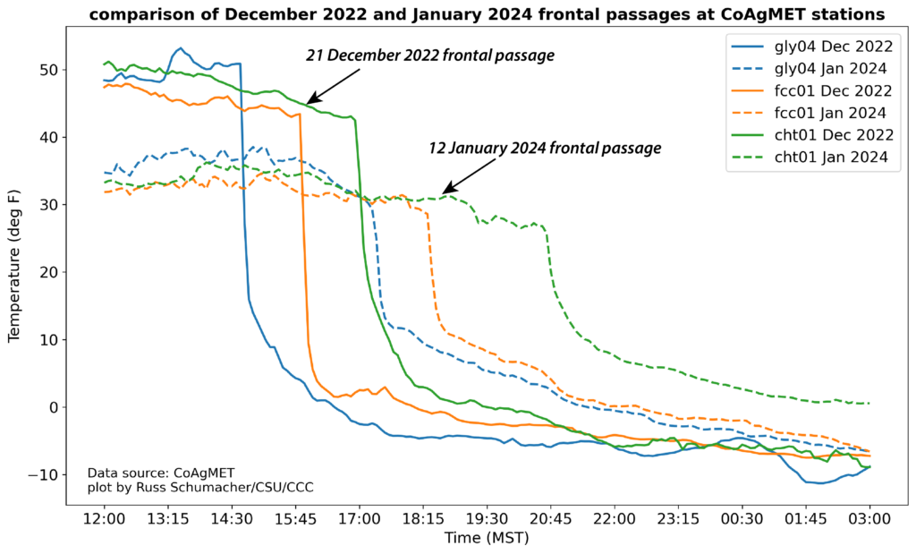
It’s pretty clear that the record-setting frontal passage from December 2022 is much stronger than what happened with this weekend’s front. The December 2022 event saw temperatures drop from above freezing to below 0°F in a few hours, with temperature drops of over 40°F in one hour. These are among the quickest temperature drops that have ever been observed with a cold front in eastern Colorado.
The January 2024 front was modest by comparison, with temperatures dropping around 20°F in an hour, and taking much longer to get below zero. One other distinction is that this wasn’t even really much of a front on the far eastern plains: many locations never rose out of the teens on the afternoon of January 12, whereas in the December 2022 front those locations also experienced very rapid temperature drops after having a warm afternoon.
An impressive Arctic front, but nothing like last December
So in summary, the Arctic front that passed on 12 January 2024 in eastern Colorado was strong, and brought in a very cold air mass, but there’s really no comparison with the extreme frontal passage from late December of 2022.