|
|
Drought Early Warning System June 30, 2020 |
|
Current Snowpack Maps ![]()

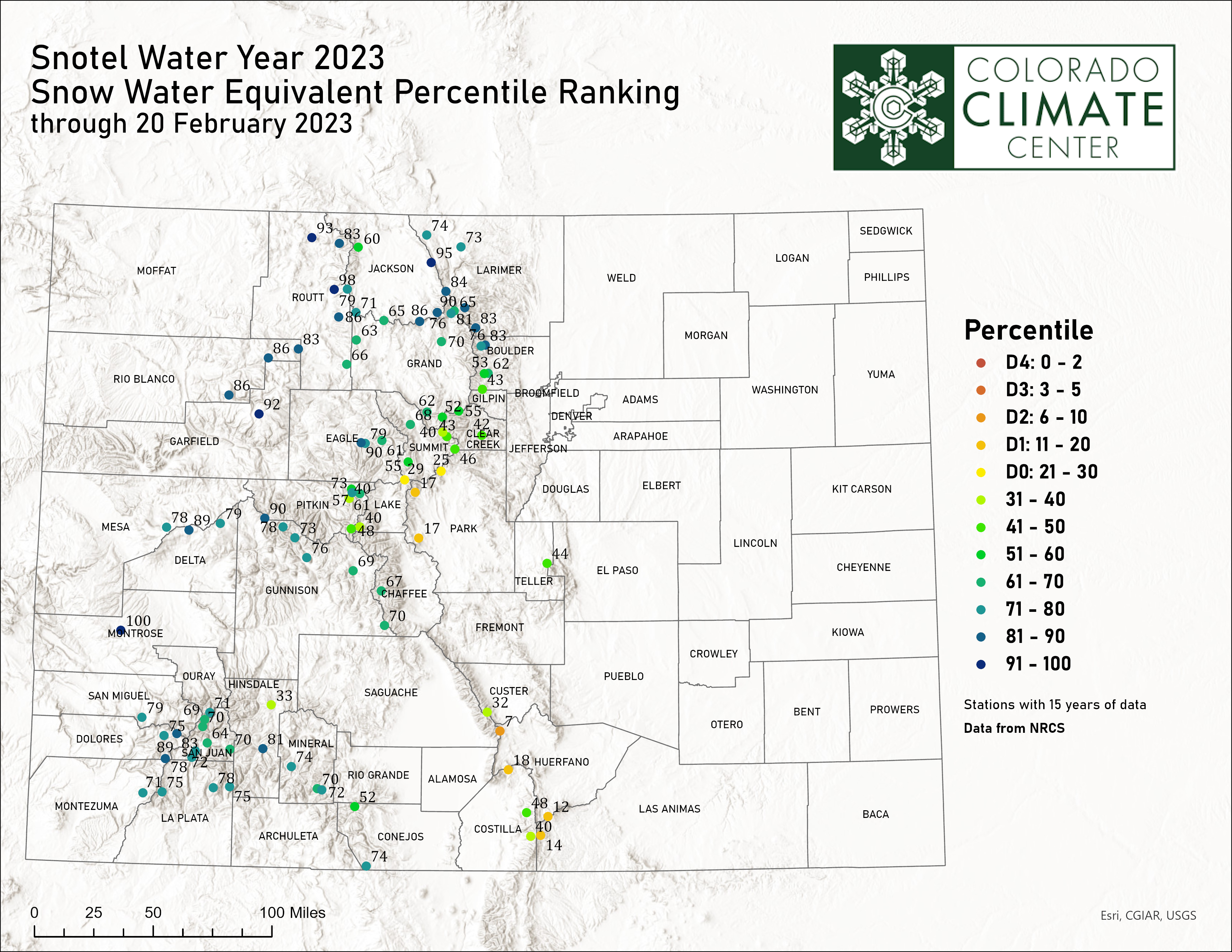
Snowpack as a percent of average map updates daily during the snow season. Values are basin-wide averages for all SNOTEL stations within that basin. Map provided by Natural Resources Conservation Service. SNOTEL percentile rankings map developed at the Colorado Climate Center and updated once a week.
SWE Time Series ![]()
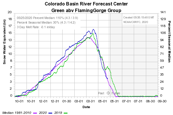
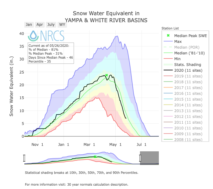
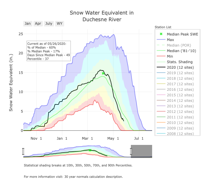
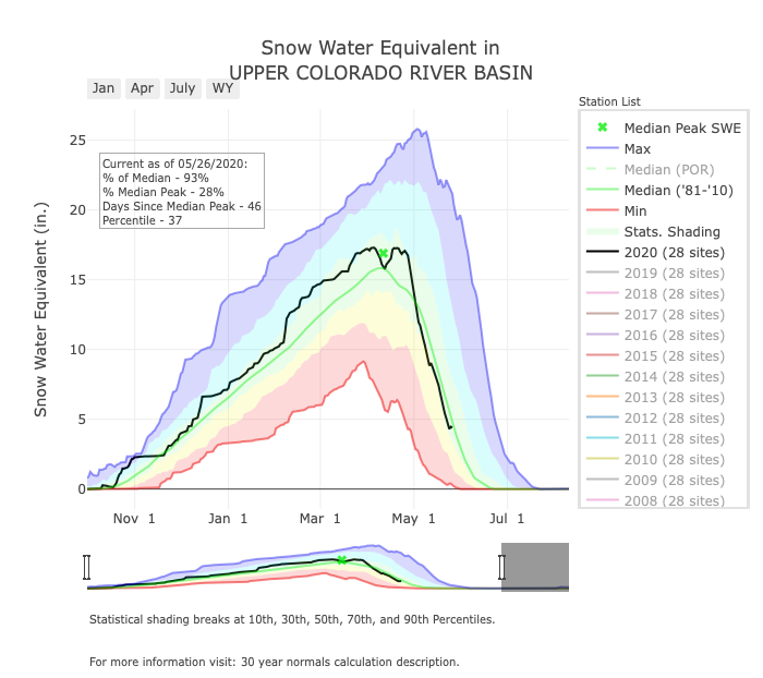
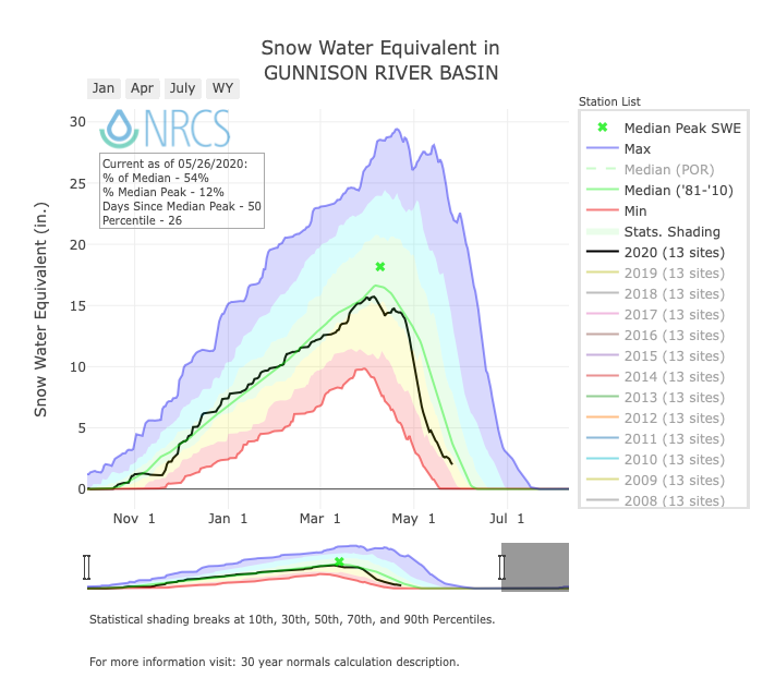
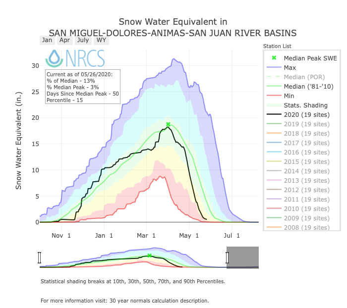
The SWE time series graphics average SWE over time for a group of SNOTEL stations in each basin. These graphs are provided by the Colorado Basin River Forecast Center. The product itself is updated daily, but on this page are typically updated every Monday during the cold season.